Perkiomen Trail
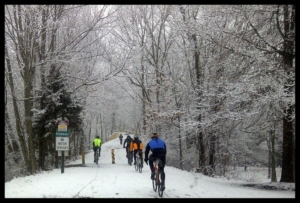
The “Perky,” as it affectionately referred to by locals, is a 20-mile route that follows the former corridor of the Perkiomen Line of the Reading Railroad. Founded shortly after the Civil War by the Perkiomen Railway Company, the Perkiomen Line carried coal, grain, stone, and the famous “Perkiomen Ice” from one of the several ice houses located along the Perkiomen Creek. This area was once a popular vacation spot and the route was widely used to access recreational areas. Today, the corridor’s legacy lives on as bikers, horseback riders, walkers, and even cross-country skiers, can take advantage of this scenic route that passes through wooded areas, town centers, suburban neighborhoods, and parks as it follows the Perkiomen Creek for much of the way.
The Perky is largely surfaced in crushed stone, although some sections are paved, but a hybrid or mountain bike is best suited for trail conditions. The route begins at Route 29 in the Borough of Green Lane and ends at the junction of the Schuylkill River Trail in Oaks. From the trail is is easy to access Green Lane Park, Central Perkiomen Valley Park, and Lower Perkiomen Valley Park, as well as the John James Audubon Center at Mill Grove and Pennypacker Mills in Schwenksville. At its southern end trail users can connect to the Schuylkill River Trail and stop to explore the stunning grounds of Valley Forge National Historic Park and the trails within the park. For more information click here.
Photos: Montgomery County Department of Assets & Infrastructure
Division of Parks, Trails & Historic Sites
Find more trail information and detailed trail maps on TrailLink.com.
Plan your trip on Traillink.com