We Need Your Input on the Tinicum ECG Trail Feasibility Study!
Authored By: Daniel Paschall | Mid-Atlantic Manager for the East Coast Greenway Alliance | January 12, 2024
Tinicum Township has the rare opportunity to create safe walking and biking access to the John Heinz National Wildlife Refuge along the East Coast Greenway and Circuit Trails – now is your chance to weigh in on the trail options with your needs and concerns!
The Tinicum East Coast Greenway Trail Feasibility Study will identify and determine a preferred alignment for a new off-road trail through Tinicum by assessing five different alternatives (see a summary below and a link to the survey here).
For reference, the East Coast Greenway (greenway.org) is a 3,000 mile long trail in development as a biking and walking path from Maine to Florida, and in Pennsylvania the Greenway is about 50% complete and acts as a major trunk trail for the Circuit Trails network in both PA and NJ. See the current East Coast Greenway interim travel route at map.greenway.org and the Circuit Trails map of planned and existing trails here, which includes sections of the future East Coast Greenway in Greater Philadelphia.
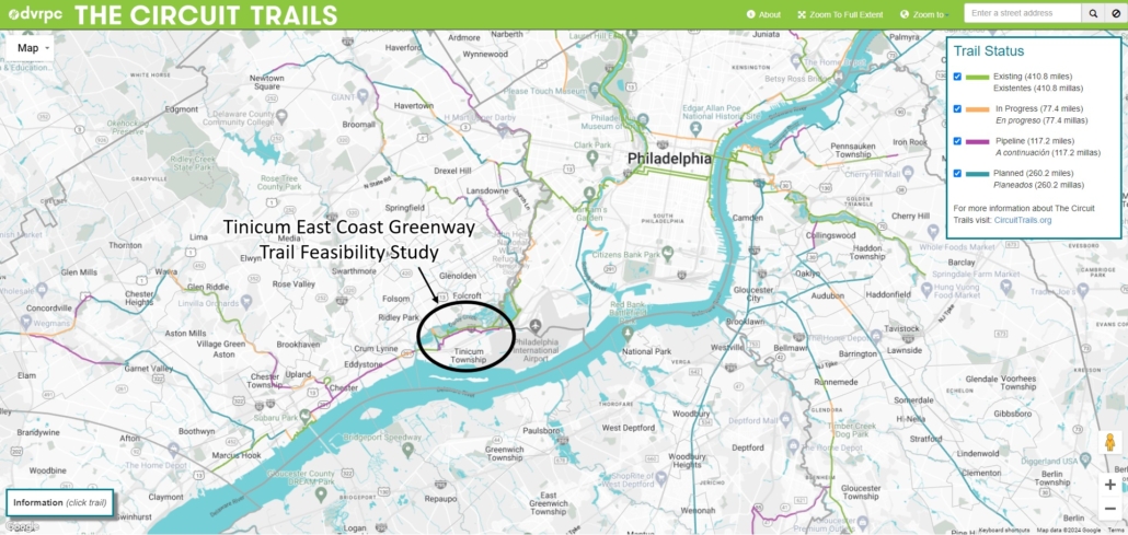
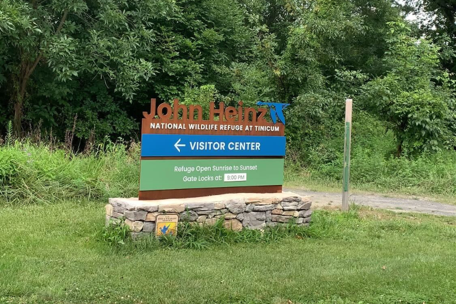
The Tinicum East Coast Greenway Trail is located near the Delaware River near where Tinicum Township in Delaware County meets Southwest Philadelphia in the John Heinz National Wildlife Refuge.
On a more local level, this trail will provide access for Tinicum to the John Heinz National Wildlife Refuge, which is less than a mile from most of the residents. However, because I-95 and a highway interchange with PA 420 Wanamaker Ave separates the Heinz Refuge from Tinicum, the only safe way to get to the Refuge is by car.
The same division also disconnects anyone looking to go from nearby Prospect Park or Southwest Philly’s Eastwick neighborhood into Tinicum Township or to the Philadelphia International Airport. For the wider region, once the East Coast Greenway is built out in Philly and Delaware County (where the trail is branded as the Industrial Heritage Trail planned along the PA 291), travelers from Wilmington, Delaware and the City of Chester will also be able to bike and hike off-road all the way to the Heinz Refuge and downtown Philly, and vice versa.
The project team, led by Traffic Planning and Design, created a set of five main alternatives (with some variations within each) to look at possible alignments of the trail from Tinicum into the Heinz Refuge. They also included a survey for the public to provide input.
Please review the project boards and fill out this online survey at: https://www.tinyurl.com/TinicumTrailSurvey
Summary of the Proposed Alternatives:
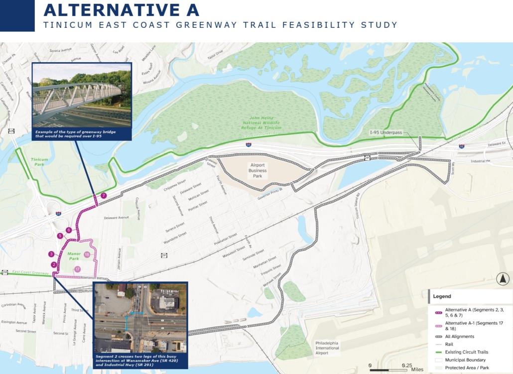
Note that all alternatives start at the SW corner of PA 291 and PA 420 (the eastern end of the existing segment of East Coast Greenway on PA 291) and head through Tinicum Township towards the John Heinz National Wildlife Refuge.
Alternative A goes directly north to the Heinz Refuge by way of a proposed bike and pedestrian bridge over I-95.
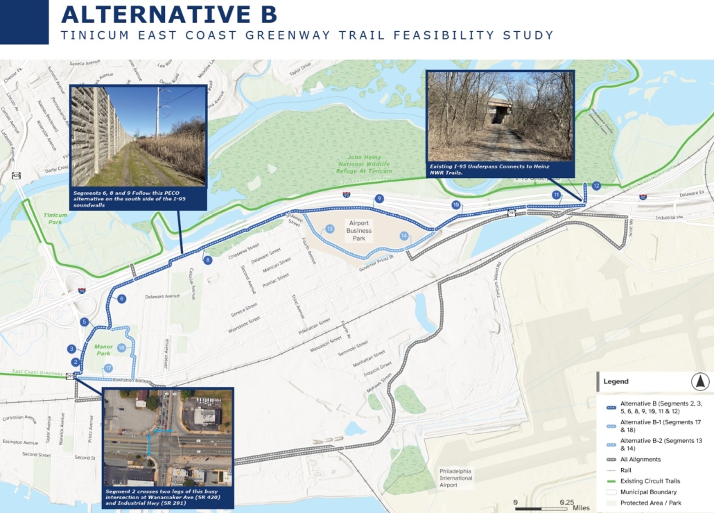
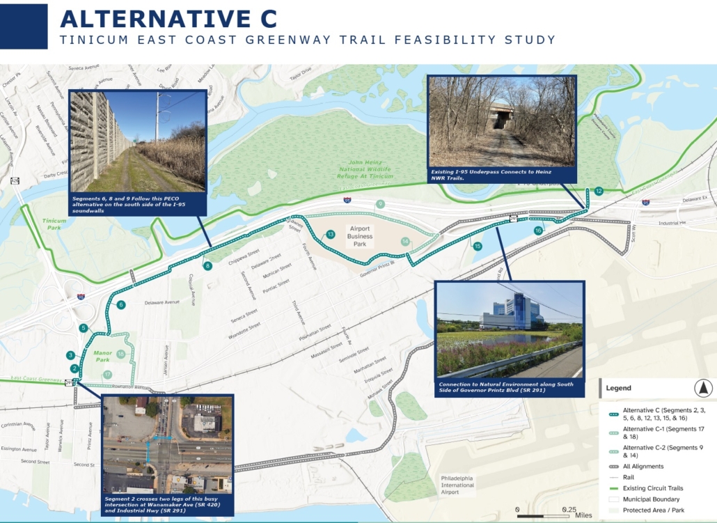
Alternatives B & C both utilize an existing unpaved access road along the south side of the I-95 sound wall, and both alternatives link to the Heinz Refuge through the I-95 underpass. The main difference is that Alternative B gets to the I-95 underpass by ramping up onto a PA 291 bridge over an exit ramp just east of the Airport Business Park and then uses the green space between I-95 and the north side of PA 291; whereas Alternative C gets to the underpass by way of the south side of PA 291 along an existing wetland that is part of the Heinz Refuge but not currently publicly accessible.
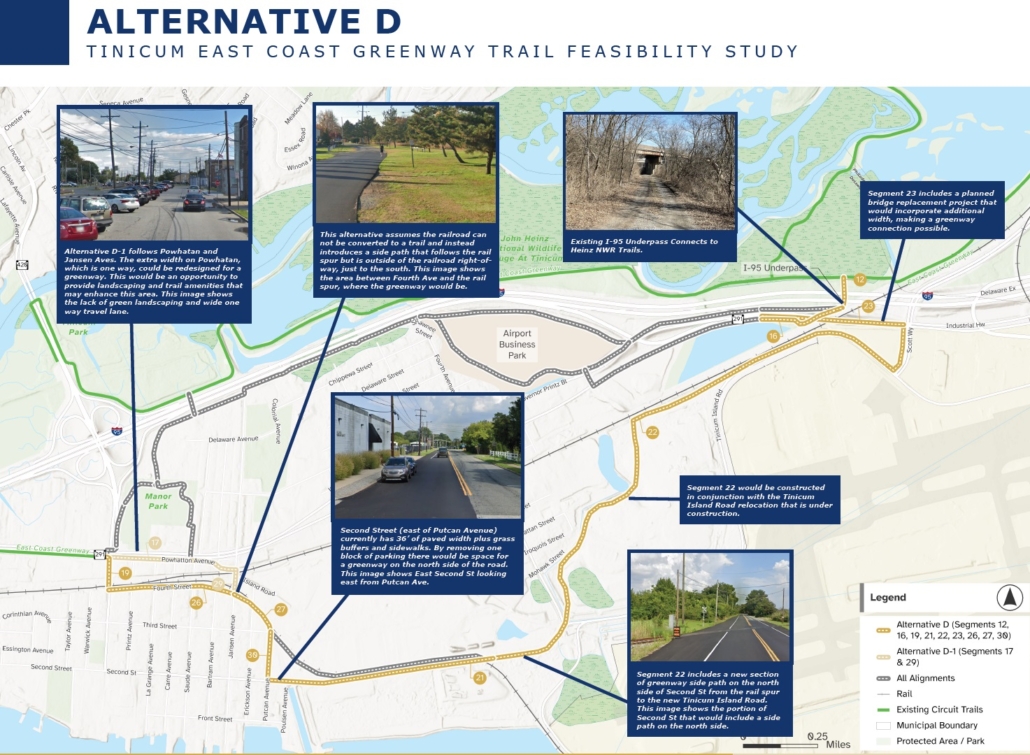
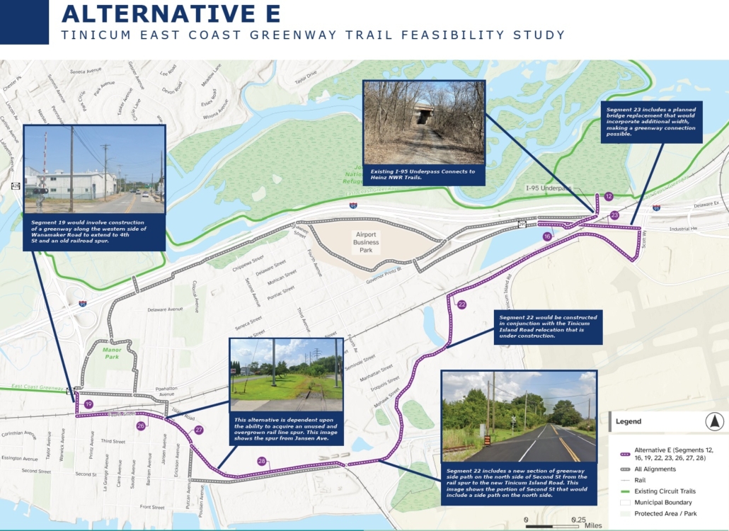
Alternatives D & E both follow a more southern route towards the Delaware River and around the edge of the Philadelphia International Airport before linking to the Heinz Refuge through the I-95 underpass. The main difference is that Alternative D proposes a series of side paths in the space parallel to roads whereas Alternative E proposes using a combination of railroad corridors and side paths parallel to roads.
In conclusion, Alternative C stands out in particular for not only utilizing already existing paths along the I-95 soundwall and the I-95 underpass, but it also features up-close views of a wetland that is already owned by US Fish and Wildlife as part of the Heinz Refuge but not currently publicly accessible. Alternative B is also worth consideration as it similarly utilizes the existing paths along the I-95 soundwall and the underpass; although this option would need to be built along the existing 291 bridge over the I-95 exit ramp and then along a utility right-of-way between I-95 and PA 291. Both B and C would likely be able to be constructed in a more timely manner than the bike and pedestrian bridge in Alternative A, and they do not require as much potential time and resources required to negotiate over the right-of-way used by utilities, railroad, or PennDOT found in Alternatives D and E.
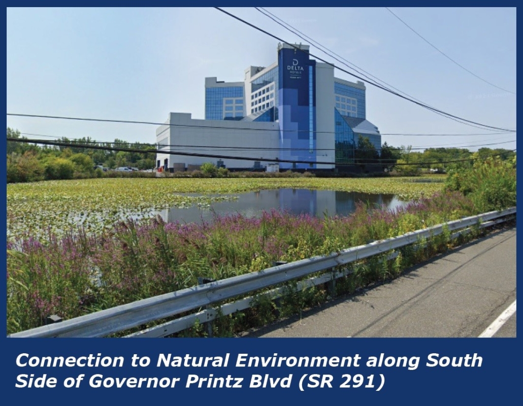
Alternative C features views of a portion of the John Heinz National Wildlife Refuge that is not currently publicly accessible.
But all of these alignments have merit and some version of them should ideally be built out eventually as part of a trail network for the whole township. Please take some time to review the many details explored by the project team and fill out the survey to provide your own input!
")
")


")
")